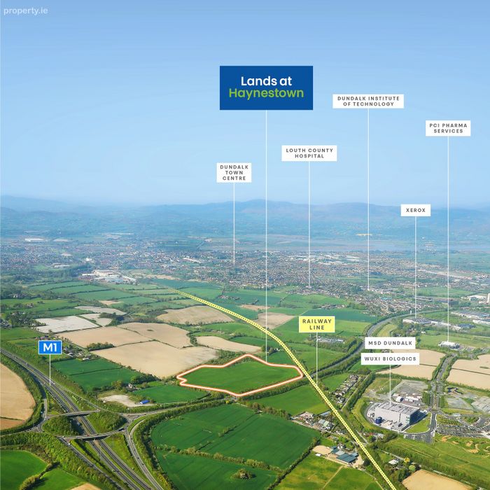
Property Description
The property comprises greenfield development lands, irregular in shape and predominantly in agricultural use, extending to a total area of 19.54 acres (7.91 ha). The lands generally have a level topography throughout. The lands are bound by agricultural and woodlands to the north, the L7165 (local road) to the west, the N52 road to the south and the Dublin-Belfast railway line / agricultural lands to the east. In addition to the Louth County Development Plan 2021 €" 2027, the property is also included in the Mullagharlin Framework Plan which designates the lands as a future hub for sustainable, high-quality employment. The plan outlines potential for up to 425,000 sq. ft. (39,540 sq. m.) of commercial space with buildings ranging in height from 3 €" 5 storeys. Notably, the framework also envisions a proposed new railway station on the Dublin-Belfast railway line along the eastern boundary of the site.
BER Details

Energy Performance Indicator: 0.00 kWh/m2/yr
This property was last updated:
6 days ago